Szerkesztő:Porbóllett/próbalap2
Megjelenés
* Trans-border site
| Név | Kép | Elhelyezkedés | Kritérium | Terület ha |
Év | Veszélyeztetett | Veszélyforrás | hivatkozások |
|---|---|---|---|---|---|---|---|---|
| Abu Mena | 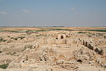
|
Abusir, é. sz. 30° 50′ 30″, k. h. 29° 39′ 50″30.841667°N 29.663889°EAbu Mena |
Kulturális: (iv) |
182 (450) | 1979 | 2001- | Víz által okozott bevágódások az agyagban. | [1][2] [3] |
| Air-hegység Természetvédelmi Terület | 
|
Arlit Department, é. sz. 18° 17′, k. h. 8° 00′18.283333°N 8.000000°EAir and Ténéré Natural Reserves |
Természeti: (vii), (ix), (x) |
7 736 000 (19 120 000) | 1991 | 1992- | Katonai konfliktusok, civil villongások, melyek a vadállatok létszámának csökkenéséhez vezettek, valamint a természeti környezet leromlása. | [4][5] |
| Aleppó óvárosa | 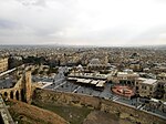
|
Aleppo Governorate, é. sz. 36° 14′ 00″, k. h. 37° 10′ 00″36.233333°N 37.166667°EAncient City of Aleppo |
Kulturális: (iii)(iv) |
350 (860) | 1986 | 2013- | A Szírirai polgárháború, amely napjainkban is zajlik. Bombázások, aknavető tüzek és lőfegyverek lövedékei. | [6] |
| Boszra ókori város | 
|
Daraa Governorate, é. sz. 32° 31′ 05″, k. h. 36° 28′ 54″32.518056°N 36.481667°EAncient City of Bosra |
Kulturális: (i)(iii)(vi) |
— | 1980 | 2013- | A Szírirai polgárháború. | [7] |
| Damaszkusz óvárosa | 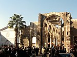
|
Damascus Governorate, é. sz. 33° 30′ 41″, k. h. 36° 18′ 23″33.511389°N 36.306389°EAncient City of Damascus |
Kulturális: (i)(ii)(iii)(iv)(vi) |
86 (210) | 1979 | 2013- | A Szírirai polgárháború, amely napjainkban is zajlik. Bombázások, aknavető tüzek és lőfegyverek lövedékei. | [8] |
| Észak-Szíria holt városai | 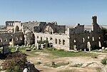
|
é. sz. 36° 20′ 03″, k. h. 36° 50′ 39″36.334167°N 36.844167°EAncient Villages of Northern Syria |
Kulturális: (iii)(iv)(v) |
12 290 (30 400) | 2011 | 2013- | A Szírirai polgárháború, amely napjainkban is zajlik. Bombázások, aknavető tüzek és lőfegyverek lövedékei. Szélsőséges iszlamista csoportok fosztogatásai. | [9] |
| Cyrene régészeti lelőhely | 
|
Jebel Akhdar,{{Flagicon|LYB}}é. sz. 32° 49′ 30″, k. h. 21° 51′ 30″32.825000°N 21.858333°EArchaeological Site of Cyrene |
Kulturális: (ii), (iii), (vi) |
— | 1982 | 2016- | A második líbiai polgárháború, fegyveres csoportok jelenléte, eddigi pusztítások és további rongálások veszélyei. | [10][11] |
| Leptis Magna régészeti lelőhely | 
|
Khoms,{{Flagicon|LYB}}é. sz. 32° 38′ 18″, k. h. 14° 17′ 35″32.638333°N 14.293056°EArchaeological Site of Leptis Magna |
Kulturális: (i), (ii), (iii) |
— | 1982 | 2016- | A második líbiai polgárháború, fegyveres csoportok jelenléte, eddigi pusztítások és további rongálások veszélyei. | [11][12] |
| Sabratha régészeti lelőhely | 
|
Sabratha,{{Flagicon|LBA}}é. sz. 32° 48′ 19″, k. h. 12° 29′ 06″32.805278°N 12.485000°EArchaeological Site of Sabratha |
Kulturális: (iii) |
— | 1982 | 2016- | A második líbiai polgárháború, fegyveres csoportok jelenléte, eddigi pusztítások és további rongálások veszélyei. | [11][13] |
| Assur (Qal'at Sherqat) | 
|
Salah ad Din, é. sz. 35° 27′ 24″, k. h. 43° 15′ 45″35.456667°N 43.262500°EAshur |
Kulturális: (iii), (iv) |
70 (170) | 2003 | 2003- | Egy tervezés alatt álló víztározó, amely a helyszín egy részét elöntené, ha elkészülne. A megfelelő védelem hiánya. | [14][15] |
| Bagrati székesegyház és a Gelati kolostor | 
|
Imereti, é. sz. 42° 15′ 44″, k. h. 42° 42′ 59″42.262222°N 42.716389°EBagrati Cathedral and Gelati Monastery |
Kulturális: (iv) |
7,87 (19,4) | 1994 | 2010- | Egy nagyobb felújítási terv részeként a helyszín összefüggő egységének megbontása és az eredeti állapot jelentős megváltoztatása miatt. | [16][17] |
| Belize Korallzátony Természetvédelmi Terület | 
|
Belize, Stann Creek és Toledo é. sz. 17° 19′, ny. h. 87° 32′17.316667°N 87.533333°WBelize Barrier Reef Reserve System |
Természeti: (vii), (ix), (x) |
96 300 (238 000) | 1996 | 2009- | A mangroveerdők kivágása és az emberi fejlődés. | [18][19] |
| Chan Chan régészeti körzete | 
|
La Libertad régió, d. sz. 8° 06′ 40″, ny. h. 79° 04′ 30″8.111111°S 79.075000°WChan Chan Archaeological Zone |
Kulturális: (i), (iii) |
600 (1500) | 1986 | 1986- | Természetes erózió | [20][21] |
| Birthplace of Jesus: Church of the Nativity and the Pilgrimage Route, Bethlehem | 
|
Bethlehem, {{Flagu|Palestine}}é. sz. 31° 42′ 16″, k. h. 35° 12′ 27″31.704444°N 35.207500°EBirthplace of Jesus: Church of the Nativity and the Pilgrimage Route, Bethlehem |
Kulturális: (iv), (vi) |
2,98 (7,4) | 2012 | 2012- | Damage due to water leaks - however current restoration work is taking place to save the site. | [22][23] |
| Comoé Nemzeti Park | 
|
Zanzan,{{Flagicon|COI}}é. sz. 9° 10′, ny. h. 3° 40′9.166667°N 3.666667°WComoé National Park |
Természeti: (ix), (x) |
1 150 000 (2 800 000) | 1983 | 2003- | Polgárháború, orrvadászat, valamint az állagmegóvás alacsony színvonala. | [24][25] |
| Coro és kikötője | 
|
Falcón, é. sz. 11° 25′, ny. h. 69° 40′11.416667°N 69.666667°WCoro and its Port |
Cultural: (iv), (v) |
107 (260) | 1993 | 2005- | 2004 novembere és 2005 februárja közt a heves esőzések miatt számos épület megrongálódott, majd egy új emlékmű, egy tengerparti sétány és egy modern beléptetőkapu épült a helyszín közvetlen közelében, ami jelentős módon megváltoztatta a helyszín egykori állapotát. | [26][27] |
| Crac des Chevaliers és a Qal’at Salah El-Din | 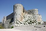
|
Homs és Latakia kormányzóságok, é. sz. 34° 46′ 54″, k. h. 36° 15′ 47″34.781667°N 36.263056°ECrac des Chevaliers and Qal’at Salah El-Din |
Kulturális: (ii)(iv) |
9 (22) | 2006 | 2013- | A Szíriai polgárháború, valamint a különböző iszlamista csoportok által történő rombolás. A kormányzat fosztogatásról és rongálásokról számolt be. | [28] |
| A Bamiyan-völgy kulturális és régészeti emlékei | {{center|
|
Bamyan,{{Flagu|Afghanistan}}é. sz. 34° 49′ 55″, k. h. 67° 49′ 36″34.831944°N 67.826667°ECultural Landscape and Archaeological Remains of the Bamiyan Valley |
Kulturális: (i), (ii), (iii), (iv), (vi) |
159 (390) | 2003 | 2003- | Az elhagyatottság miatti törékeny állapot, katonai akciók, robbantások jelentenek veszélyt. Fosztogatás és rombolás fordulhat elő a szélsőséges iszlamista csoportok felbukkanása miatt. | [29][30] |
| Keleti-Rennell-korallzátony | 
|
Rennell and Bellona Province,{{Flagu|Solomon Islands}}d. sz. 11° 40′ 59″, k. h. 160° 10′ 59″11.683056°S 160.183056°EEast Rennell |
Természeti: (ix) |
37 000 (91 000) | 1998 | 2013- | Illegális fakitermelés okozta károk káros hatása a helyi élővilágra. | [31] |
| Everglades Nemzeti Park | 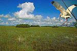
|
Florida, é. sz. 25° 19′, ny. h. 80° 56′25.316667°N 80.933333°WEverglades National Park |
Természeti: (viii), (ix), (x) |
592 920 (1 465 100) | 1979 | 1993–2007, 2010- | Damage due to Hurricane Andrew and deterioration of water flow and quality due to agricultural and urban development (1993); continued degradation of the site resulting in a loss of marine habitat and decline in marine species (2010) | [32][33] [34] |
| Fortifications on the Caribbean Side of Panama: Portobelo-San Lorenzo | 
|
Colón Province, é. sz. 9° 33′ 14″, ny. h. 79° 39′ 21″9.553889°N 79.655833°WFortifications on the Caribbean Side of Panama: Portobelo-San Lorenzo |
Kulturális: (i), (iv) |
— | 1980 | 2012- | Környezeti tényezők, a karbantartás hiánya és városi fejlesztések. | [35][36] |
| Garamba Nemzeti Park | 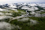
|
Orientale, é. sz. 4° 00′, k. h. 29° 15′4.000000°N 29.250000°EGaramba National Park |
Természeti: (vii), (x) |
500 000 (1 200 000) | 1980 | 1984–1992, 1996- | Reduction of Northern White Rhinoceros population (1984); poaching of two white rhinos, killing of three rangers and no plan for corrective measures by the authorities (1996) | [37][38] [39] |
| Hatra | {{center|
|
Nineveh Governorate, é. sz. 35° 35′ 17″, k. h. 42° 43′ 06″35.588060°N 42.718330°EHatra |
Kulturális: (ii), (iii), (iv), (vi) |
324 (800) | 1985 | 2015- | Fegyveres erők károkat okoztak a helyszínen. | [40] |
| Historic Centre of Shakhrisyabz | 
|
Qashqadaryo Region, é. sz. 39° 03′ 00″, k. h. 66° 50′ 00″39.050000°N 66.833333°EHistoric Centre of Shakhrisyabz |
Kulturális: (iii), (iv) |
240 (590) | 2000 | 2016- | A középkori városrész épített környezetének rombolása, városi fejlesztések. | [41][42] |
| Zabīd történelmi városrésze | {{center|
|
Al Hudaydah, é. sz. 14° 12′, k. h. 43° 19′14.200000°N 43.316667°EHistoric Town of Zabīd |
Kulturális: (ii), (iv), (vi) |
— | 1993 | 2000- | Deteriorating state of historic buildings, inscribed on request of the State Party | [43][44] |
| Humberstone és Santa Laura Salétrom Művek | 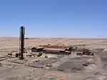
|
Tarapacá,{{Flagu|Chile}}d. sz. 20° 12′ 30″, ny. h. 69° 47′ 40″20.208333°S 69.794444°WHumberstone and Santa Laura Saltpeter Works |
Kulturális: (ii), (iii), (iv) |
— | 2005 | 2005- | Fragile nature of structures due to lack of maintenance for 40 years; also damage, vandalism and some dismantling; looting | [45][46] |
| Kahuzi-Biéga Nemzeti Park | {{center|
|
South Kivu and Maniema, {{Flagu|Democratic Republic of the Congo}}d. sz. 2° 30′, k. h. 28° 45′2.500000°S 28.750000°EKahuzi-Biega National Park |
Természeti: (x) |
600 000 (1 500 000) | 1980 | 1997- | Erdőirtás, vadászat, háború és az emberek beavatkozásai | [47][48] |
| Liverpool – Maritime Mercantile City | {{center|
|
Liverpool England, {{Flagu|United Kingdom}}é. sz. 53° 24′ 24″, ny. h. 2° 50′ 40″53.406667°N 2.844444°WLiverpool – Maritime Mercantile City |
Kulturális: (ii), (iii), (iv) |
136 (340) | 2004 | 2012- | Due to the proposed redevelopment of historic docklands known as Liverpool Waters | [49][50] |
| Manovo-Gounda St Floris National Park | 
|
Bamingui-Bangoran,{{Flagu|Central African Republic}}é. sz. 9° 00′, k. h. 21° 30′9.000000°N 21.500000°EManovo-Gounda St Floris National Park |
Természeti: (ix), (x) |
1 740 000 (4 300 000) | 1988 | 1997- | Illegal grazing and poaching, deteriorating security situation | [51][52] |
| Dzsam minaretje és régészeti emlékhelyei | 
|
Ghōr, é. sz. 34° 23′ 48″, k. h. 64° 30′ 58″34.396667°N 64.516111°EMinaret and Archaeological Remains of Jam |
Kulturális: (ii), (iii), (iv) |
70 (170) | 2002 | 2002- | A törvényi védelem hiánya, műemlékvédelmi és fenntartási problémák, valamint a helyszín általánosan rossz állapota. | [53][54] |
| Koszovó középkori műemlékei | 
|
Kosovo[a] é. sz. 42° 39′ 40″, k. h. 20° 15′ 56″42.661111°N 20.265556°EMedieval Monuments in Kosovo |
Kulturális: (ii), (iii), (iv) |
2,88 (7,1) | 2004 | 2006- | Törvényi védelem hiánya, politikai bizonytalanság és biztonsági kockázatok. | [55][56] |
| Mount Nimba Strict Nature Reserve | 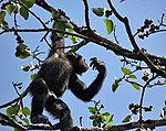
|
Lola Prefecture,{{Flagicon|COI}}*{{Flagu|Guinea}}*é. sz. 7° 36′, ny. h. 8° 23′7.600000°N 8.383333°WMount Nimba Strict Nature Reserve |
Természeti: (ix), (x) |
18 000 (44 000) | 1981 | 1992- | Vasércbányászat a világörökségi helyszín egyes részein és számos menekült a helyszín guineai oldalán. | [57][58] |
| Nan Madol: Ceremonial Centre of Eastern Micronesia | 
|
Temwen Island,{{Flagu|Micronesia}}é. sz. 6° 50′ 23″, k. h. 158° 19′ 51″6.839722°N 158.330833°ENan Madol: Ceremonial Centre of Eastern Micronesia |
Kulturális: (i), (iii), (iv), (vi) |
76,7 (190) | 2016 | 2016- | Continuing siltation of waterways contributing to overgrowth and undermining existing structures. | [59][60] |
| Niokolo-Koba Nemzeti Park | 
|
Tambacounda Region and Kédougou Region, é. sz. 13° 00′, ny. h. 12° 40′13.000000°N 12.666667°WNiokolo-Koba National Park |
Természeti: (x) |
913 000 (2 260 000) | 1981 | 2007- | Degradation of property, low mammal population, management problems and impact of a proposed dam on the Gambia River | [61][62] |
| Okapi Vadrezervátum | 
|
Orientale, é. sz. 2° 00′, k. h. 28° 30′2.000000°N 28.500000°EOkapi Wildlife Reserve |
Természeti: (x) |
1 372 625 (3 391 830) | 1996 | 1997- | Looting of park facilities and killing of elephants as a result of an armed conflict in the area | [63][64] |
| Old City of Jerusalem and its Walls | 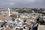
|
Jerusalem District (no nation named by UNESCO)[nb 1] é. sz. 31° 46′ 36″, k. h. 35° 14′ 03″31.776667°N 35.234167°EOld City of Jerusalem and its Walls |
Kulturális: (ii), (iii), (vi) |
— | 1981 | 1982- | Ellenőrzés nélküli városfejlesztés, állagmegóvás hiánya, a turizmus túlzott jelenléte. | [65][66][67] |
| Old City of Sana'a | {{center|
|
Sana'a Governorate, é. sz. 15° 21′ 20″, k. h. 44° 12′ 29″15.355556°N 44.208056°ESana'a |
Kulturális: (iv), (v), (vi) |
— | 1986 | 2015- | Yemeni Civil War, Saudi Arabian-led coalition airstrikes on the area.[68] | [69] |
| Old Town of Ghadamès | 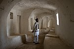
|
Ghadames,{{Flagicon|LYB}}é. sz. 30° 08′ 00″, k. h. 9° 30′ 00″30.133333°N 9.500000°EOld Town of Ghadamès |
Kulturális: (v) |
— | 1986 | 2016- | Libyan Civil War, presence of armed groups, already incurred and potential further damage. | [11][70] |
| Old Towns of Djenné | 
|
Djenné, é. sz. 13° 54′ 23″, ny. h. 4° 33′ 18″13.906389°N 4.555000°WOld Towns of Djenné |
Kulturális: (iii), (iv) |
— | 1988 | 2016- | Regionális biztonsági kockázatok miatt bizonytalan a történelmi városmag helyzete, valamint veszélyt jelent a városiasodás és az erózió is. | [71][72] |
| Old Walled City of Shibam | {{center|
|
Hadhramaut Governorate, é. sz. 15° 55′ 37″, k. h. 48° 37′ 36″15.926940°N 48.626670°EShibam |
Kulturális: (iii), (iv), (v) |
— | 1982 | 2015- | Fegyveres konfliktusok kialakulásának veszélye, biztonsági kockázatokkal és fenntartói hibákkal. | [69] |
| Atsinanana esőerdői | {{center|
|
Eastern Madagascar, d. sz. 14° 28′, k. h. 49° 42′14.466667°S 49.700000°ERainforests of the Atsinanana |
Természeti: (ix), (x) |
479 660 (1 185 300) | 2007 | 2010- | Az illegális fakitermelés és a veszélyeztetett lemurok vadászata miatt. | [73][74] |
| Río Plátano Bioszféra-rezervátum | 
|
La Mosquitia, é. sz. 15° 44′ 40″, ny. h. 84° 40′ 30″15.744444°N 84.675000°WRío Plátano Biosphere Reserve |
Natural: (vii), (viii), (ix), (x) |
— | 1982 | 1996–2007, 2011- | Logging, fishing and land occupation; poaching and the reduced capacity of the state to manage the site; largely due to the deterioration of law and to the presence of drug traffickers | [75][76] |
| Rock-Art Sites of Tadrart Acacus | 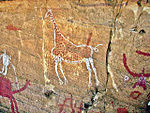
|
Fezzan,{{Flagicon|LYB}}é. sz. 24° 50′ 00″, k. h. 10° 20′ 00″24.833333°N 10.333333°ERock-Art Sites of Tadrart Acacus |
Kulturális: (iii) |
— | 1985 | 2016- | Libyan Civil War, presence of armed groups, already incurred and potential further damage. | [11][77] |
| Ruins of Kilwa Kisiwani and Ruins of Songo Mnara | {{center|
|
Kilwa District, d. sz. 8° 57′ 28″, k. h. 39° 31′ 22″8.957778°S 39.522778°ERuins of Kilwa Kisiwani and Ruins of Songo Mnara |
Kulturális: (iii) |
— | 1981 | 2004- | Continuing deterioration of the site due to various agents such as erosion or plants | [78][79] |
| Salonga Nemzeti Park | 
|
Équateur and Bandundu Province, d. sz. 2° 00′, k. h. 21° 00′2.000000°S 21.000000°ESalonga National Park |
Természeti: (vii), (ix) |
3 600 000 (8 900 000) | 1984 | 1999- | Az állami ellenőrzés megszűnése | [80][81] [82] |
| Szamarra ókori város | 
|
Salah ad Din, é. sz. 34° 12′, k. h. 43° 52′34.200000°N 43.866667°ESamarra Archaeological City |
Kulturális: (ii), (iii), (iv) |
15 058 (37 210) | 2007 | 2007- | Az Iraki háborút követő biztonsági helyzet gyengülése, valamint az állami ellenőrzés hiánya a helyszín védelme terén. | [83][84] |
| Simien National Park | 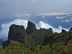
|
Amhara Region,{{Flagicon|ETI}}é. sz. 13° 11′, k. h. 38° 04′13.183333°N 38.066667°ESimien National Park |
Természeti: (vii), (x) |
22 000 (54 000) | 1978 | 1996- | A Walia ibex állományának csökkenése | [85][86] |
| Site of Palmyra | 
|
Homs Governorate, é. sz. 34° 33′ 15″, k. h. 38° 16′ 00″34.554167°N 38.266667°ESite of Palmyra |
Kulturális: (i)(ii)(iv) |
0,36 (0,89) | 1980 | 2013- | A Szíriai polgárháború, valamint az Iszlám Állam általi fenyegetettség, amióta elfoglalták a területet. | [87] |
| Timbuktu | 
|
Timbuktu, Timbuktu régió, {{Flagu|Mali}}é. sz. 16° 46′ 24″, ny. h. 2° 59′ 58″16.773333°N 2.999444°WTimbuktu |
Kulturális: (ii), (iv), (v) |
— | 1988 | 2012- | Threat of destruction by the Islamist groups like Al-Qaeda in Islamic Maghreb, Ansar Dine and Boko Haram. Some monuments are now pillaged and destroyed. | [88][89] |
| Tomb of Askia | 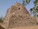
|
Gao, Gao Region, {{Flagu|Mali}}é. sz. 16° 17′ 22″, k. h. 0° 02′ 42″16.289333°N 0.044911°ETomb of Askia |
Cultural: (ii), (iii), (iv) |
4,24 (10,5) | 2004 | 2012- | Damaged by Islamist groups like Al-Qaeda in Islamic Maghreb and Ansar Dine. Reported destroyed by Ansar Dine when they captured Timbuktu. | [89][90] |
| Tombs of Buganda Kings at Kasubi | 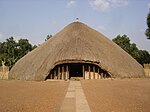
|
Kampala District,{{Flagu|Uganda}}é. sz. 0° 19′ 45″, k. h. 32° 33′ 12″0.329167°N 32.553333°ETombs of Buganda Kings at Kasubi |
Kulturális: (i), (iii), (iv), (vi) |
27 (67) | 2001 | 2010- | Destruction of the Muzibu Azaala Mpanga, the main building of the site, by fire in March 2010 | [91][92] |
| Tropical Rainforest Heritage of Sumatra | Sumatra,{{Flagu|Indonesia}}d. sz. 2° 30′, k. h. 101° 30′2.500000°S 101.500000°ETropical Rainforest Heritage of Sumatra |
Természeti: (vii), (ix), (x) |
2 595 124 (6 412 690) | 2004 | 2011- | Poaching, illegal logging, agricultural encroachment, and plans to build roads through the site | [93][94] | |
| Virunga Nemzeti Park | 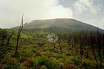
|
North Kivu and Orientale, é. sz. 0° 55′, k. h. 29° 10′0.916667°N 29.166667°EVirunga National Park |
Természeti: (vii), (viii), (x) |
800 000 (2 000 000) | 1979 | 1994- | Erdőirtás, orrvadászat a ruandai polgárháborút követő menekülthullám nyomán. | [95][96] |
| Palestine: Land of Olives and Vines – Cultural Landscape of Southern Jerusalem, Battir | 
|
Battir, {{Flagu|Palestine}}é. sz. 31° 43′ 11″, k. h. 35° 07′ 50″31.719722°N 35.130556°EPalestine: Land of Olives and Vines – Cultural Landscape of Southern Jerusalem, Battir |
Cultural: (iv)(v) |
349 (860) | 2014 | 2014- | The Israeli West Bank barrier "may isolate farmers from fields they have cultivated for centuries". | [97][98] |
A listán korábban szerepelt világörökségi helyszínek
[szerkesztés]Számos olyan világörökségi helyszín van, amely korábban szerepelt a veszélyeztetett világörökségi helyszínek között, de a későbbiek során eltávolították őket a listáról különböző fejlesztések, valamint az állagmegóvás és fenntartás feltételeinek javulása miatt. Az Everglades Nemzeti Park was listed from 1993-tól 2007-ig szerepelt a listán, majd 2010-től ismét felkerült; a Río Plátano Bioszféra-rezervátum 1996-tól 2007-ig szerepelt a listán, majd 2011-ben újra felkerült. Ezért mindkettő helyszín a fenti listában szerepel.
- Delisted as a World Heritage Site
| Név | Kép | Elhelyezkedés | Kritériumok | Terület ha |
Év (WHS) | Veszélyeztetett | Veszély oka | Hivatkozások |
|---|---|---|---|---|---|---|---|---|
| Angkor | 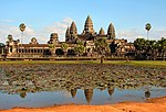
|
Siem Reap Province, {{Flagu|Cambodia}}é. sz. 13° 26′, k. h. 103° 50′13.433333°N 103.833333°EAngkor |
Kulturális: (i), (ii), (iii), (iv) |
{{center|—}}
|
1992 | 1992–2004 | Inscription initially limited to a three-year period (1993–1995) during which effective legal protection, boundary and buffer zones were to be established and international conservation efforts were to be monitored and coordinated; at the time of inscription, Cambodia was UN-controlled following the civil war in the 1980s. | [99][100] [101] |
| Bahla-erőd | 
|
Bahla, é. sz. 22° 58′, k. h. 57° 18′22.966667°N 57.300000°EBahla Fort |
CKlturális: (iv) |
{{center|—}}
|
1987 | 1988–2004 | Degradation of earth structures of the fort and of the oasis of Bahla | [102][103] [104][105] |
| Bam and its Cultural Landscape | 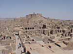
|
Kerman,{{Flagu|Iran}}é. sz. 29° 07′ 01″, k. h. 58° 22′ 07″29.116944°N 58.368611°EBam and its Cultural Landscape |
Kulturális: (ii), (iii), (iv), (v) |
— | 2004 | 2004–2013 | Following the damage due to the 2003 Bam earthquake | [106][107][108] |
| Butrint | 
|
Sarandë District, é. sz. 39° 45′, k. h. 20° 01′39.750000°N 20.016667°EButrint |
Kulturális: (iii) |
3980 (9800) | 1992 | 1997–2005 | Damages due to management and conservation Az épület fennt | [109][110] [111] |
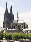
| Cologne Cathedral | {{center|
|
North Rhine-Westphalia, é. sz. 50° 56′ 29″, k. h. 6° 57′ 29″50.941389°N 6.958056°ECologne Cathedral |
Kulturális: (i), (ii), (iv) |
{{center|—}}
|
1996 | 2004–2006 | High-rise building plan near the cathedral threatening to inflict damage to the integrity of the property; delisted[nb 2] after the building plan was halted and a buffer zone introduced | [112][113] [114] |
| Djoudj National Bird Sanctuary | 
|
Biffeche, {{Flagu|Senegal}}é. sz. 16° 30′, ny. h. 16° 10′16.500000°N 16.166667°WDjoudj National Bird Sanctuary |
Természeti: (vii), (x) |
16 000 (40 000) | 1981 | 1984–1988, 2000–2006 | Long term threat by construction plan for a down-stream dam (1984); delisted[nb 2] (1988) as water supply to the park was insured by the construction of a sluice and a management plan was being prepared; relisted[nb 3] (2000) due to environmental and economical threats posed by the introduced species Salvinia molesta and Pistia stratiotes as well as issues with water management in the park | [38][115] [116][117] [118][119] |
| Dresden Elbe Valley | 
|
Saxony, é. sz. 51° 03′, k. h. 13° 49′51.050000°N 13.816667°EDresden Elbe Valley |
Kulturális: (ii), (iii), (iv), (v) |
1930 (4800) | 2004 | 2006–2009 | A Waldschlösschen-híd építési tervei miatt 2009-ben, két évvel a híd építését követően törölték a világörökség listájáról | [120][121] |
| Dubrovnik | 
|
Dubrovnik-Neretva County, {{Flagu|Croatia}}é. sz. 42° 38′ 25″, k. h. 18° 06′ 30″42.640278°N 18.108333°EDubrovnik |
Kulturális: (i), (iii), (iv) |
97 (240) | 1979 | 1991–1998 | Délszláv háború | [122][123] [124] |
| Fort and Shalamar Gardens in Lahore | 
|
Punjab, é. sz. 31° 35′ 25″, k. h. 74° 18′ 35″31.590278°N 74.309722°EFort and Shalamar Gardens in Lahore |
Kulturális: (i), (ii), (iii) |
— | 1981 | 2000–2012 | Destruction of historic water tanks in 1999 to widen a road and deteriorating perimeter walls of the Garden, listed on request of the Pakistan government | [125][126] |
| Galápagos-szigetek | 
|
Galápagos Province, d. sz. 0° 40′, ny. h. 90° 30′0.666667°S 90.500000°WGalápagos Islands |
Természeti: (vii), (viii), (ix), (x) |
14 066 514 (34 759 110) | 1978 | 2007–2010 | Various threats including insufficient prevention of possibilities for the introduction of alien species, insufficient resource allocation for conservation agencies and park management, presence of a large number of illegal immigrants, rapid uncontrolled growth of tourism, fishing over-capacity and sports fishing | [127][128] [129][130] |
| Mtskheta történelmi műemlékei | 
|
Mtskheta-Mtianeti, é. sz. 41° 51′, k. h. 44° 43′41.850000°N 44.716667°EHistorical Monuments of Mtskheta |
Kulturális: (iii), (iv) |
— | 1994 | 2009-2016 | Concerns about the preservation of the site | [131][132] |
| Group of Monuments at Hampi | {{center|
|
Bellary district, {{Flagu|India}}é. sz. 15° 20′ 06″, k. h. 76° 27′ 43″15.335000°N 76.461944°EGroup of Monuments at Hampi |
Kulturális: (i), (iii), (iv) |
{{center|—}}
|
1986 | 1999–2006 | Partial construction of two cable-suspended bridges within the protected archaeological areas of Hampi threatening the integrity and authenticity of the site | [133][134] [135] |
| Ichkeul Nemzeti Park | 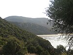
|
Bizerta, é. sz. 37° 10′, k. h. 9° 40′37.166667°N 9.666667°EIchkeul National Park |
Természeti: (x) |
12 600 (31 000) | 1980 | 1996–2006 | Construction of dams limiting the freshwater flow to the area and causing an increased salinity of the lake and the marshes as well as a decrease in the number of migrating bird populations | [136][137] [138] |
| Iguaçu Nemzeti Park | 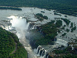
|
Paraná State, d. sz. 25° 41′, ny. h. 54° 26′25.683333°S 54.433333°WIguaçu National Park |
Természeti: (vii), (x) |
170 086 (420 290) | 1986 | 1999–2001 | Illegally opened road ("Estrada do Colono", Portuguese for "Settler's Road") through the park, dams on the Iguazu River and helicopter flights. | [82][139] [140] |
| Kathmandu-völgy | 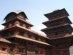
|
Kathmandu Valley, é. sz. 27° 42′ 14″, k. h. 85° 18′ 31″27.703889°N 85.308611°EKathmandu Valley |
Kulturális: (iii), (iv), (vi) |
167 (410) | 1979 | 2003–2007 | Partial or substantial loss of the traditional elements of six out of seven monument zones and resulting general loss of authenticity and integrity of the whole property. | [141][142] [143] |
| Los Katíos National Park | 
|
Antioquia and Chocó, {{Flagu|Colombia}}é. sz. 7° 40′ 00″, ny. h. 77° 00′ 00″7.666667°N 77.000000°WLos Katíos National Park |
Természeti: (ix), (x) |
72 000 (180 000) | 1994 | 2009–2015 | Erdőirtás, illegális halászat és orrvadászat. A park igazgatóságának hatásos lépéseit követően lekerült a veszélyeztetett örökségi helyszínek listájáról. [144] | |
| Manas Wildlife Sanctuary | {{center|
|
Assam, {{Flagu|India}}é. sz. 26° 30′, k. h. 91° 51′26.500000°N 91.850000°EManas Wildlife Sanctuary |
Natural: (vii), (ix), (x) |
39 100 (97 000) | 1985 | 1992–2011 | Poaching, damage to the park's infrastructure and decrease in the population of some species particularly the Greater One Horned Rhino following an invasion by militants of the Bodo tribe in 1992 | [145][146] [147] |
| Natural and Culturo-Historical Region of Kotor | 
|
Bay of Kotor, Kotor and surrounding territory, {{Flagu|Montenegro}}é. sz. 42° 29′, k. h. 18° 42′42.483333°N 18.700000°ENatural and Culturo-Historical Region of Kotor |
Cultural: (i), (ii), (iii), (iv) |
{{center|—}}
|
1979 | 1979–2003 | Damage following the earthquake from April 15, 1979 | [148][149] [150] |
| Ngorongoro Conservation Area | 
|
Arusha Region, {{Flagu|Tanzania}}d. sz. 3° 11′, k. h. 35° 32′3.183333°S 35.533333°ENgorongoro Conservation Area |
Natural: (iv), (vii), (viii), (ix), (x) |
{{center|—}}
|
1978 | 1984–1989 | Declining conservation status | [151][152] [153] |
| Plitvice Lakes National Park | 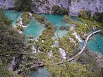
|
Lika-Senj County, {{Flagu|Croatia}}é. sz. 44° 53′, k. h. 15° 37′44.883333°N 15.616667°EPlitvice Lakes National Park |
Natural: (vii), (viii), (ix) |
19 200 (47 000) | 1979 | 1992–1997 | Potential threat due to the Croatian War of Independence | [154][155] [156] |
| Rice Terraces of the Philippine Cordilleras | 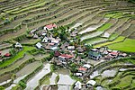
|
Ifugao,{{Flagu|Philippines}}é. sz. 16° 55′, k. h. 121° 03′16.916667°N 121.050000°ERice Terraces of the Philippine Cordilleras |
Cultural: (iii), (iv), (v) |
500 000 (1 200 000) | 1995 | 2001–2012 | Absence of systematic monitoring programme or a comprehensive management plan | [157][158] |
| Royal Palaces of Abomey | 
|
Zou Department, {{Flagu|Benin}}é. sz. 7° 11′ 26″, k. h. 1° 59′ 36″7.190556°N 1.993333°ERoyal Palaces of Abomey |
Cultural: (iii), (iv) |
48 (120) | 1985 | 1985–2007 | General state of deterioration due to the elements and inappropriate restoration which are in conflict with the authenticity of the site | [159][160] [161][162] |
| Rwenzori Mountains National Park | 
|
Bundibugyo, Kabarole and Kasese District, {{Flagu|Uganda}}é. sz. 0° 13′, k. h. 29° 55′0.216667°N 29.916667°ERwenzori Mountains National Park |
Natural: (vii), (ix) |
99 600 (246 000) | 1994 | 1999–2004 | Security situation and lack of monitoring of a major part of the park | [82][163] [164] |
| Sangay National Park | 
|
Chimborazo, Morona-Santiago and Tungurahua Province, {{Flagu|Ecuador}}d. sz. 1° 50′, ny. h. 78° 20′1.833333°S 78.333333°WSangay National Park |
Natural: (vii), (viii), (ix), (x) |
271 925 (671 940) | 1983 | 1992–2005 | Heavy poaching, illegal livestock grazing, encroachment and potential threat through a road construction project | [165][166] [167] |
| Srebarna Nature Reserve | 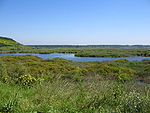
|
Srebarna, Silistra Province, {{Flagu|Bulgaria}}é. sz. 44° 06′ 50″, k. h. 27° 04′ 40″44.113889°N 27.077778°ESrebarna Nature Reserve |
Natural: (x) |
638 (1580) | 1983 | 1992–2003 | Prevention of seasonal flooding and agricultural use causing a decline or disappearance of the water and passerine bird populations | [168][169] [170] |
| Timbuktu | 
|
Circle and Region of Tombouctou, {{Flagu|Mali}}é. sz. 16° 46′ 24″, ny. h. 2° 59′ 58″16.773333°N 2.999444°WTimbuktu |
Cultural: (ii), (iv), (v) |
{{center|—}}
|
1988 | 1990–2005 | Threat of sand encroachment | [171][172] [173] |
| Tipasa | 
|
Tipaza Province, {{Flagu|Algeria}}é. sz. 36° 33′ 24″, k. h. 2° 23′ 00″36.556667°N 2.383333°ETipasa |
Cultural: (iii), (iv) |
52 (130) | 1982 | 2002–2006 | Inadequate maintenance affecting the integrity of the site and its buffer zone | [174][175] [176] |
| Walled City of Baku with Shirvanshah's Palace and Maiden Tower | 
|
Baku, {{Flagu|Azerbaijan}}é. sz. 40° 21′ 59″, k. h. 49° 50′ 07″40.366361°N 49.835278°EBaku |
Cultural: (iv) |
{{center|—}}
|
2000 | 2003–2009 | Earthquake | [177] |
| Wieliczka-sóbánya | 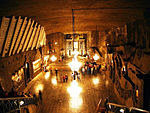
|
Wieliczka, Wieliczka County, Lesser Poland Voivodeship, é. sz. 49° 58′ 45″, k. h. 20° 03′ 50″49.979167°N 20.063889°EWieliczka Salt Mine |
Cultural: (iv) |
969 (2390) | 1978 | 1989–1998 | Humidity problem | [153][178] [179] |
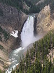
| Yellowstone National Park | {{center|
|
Wyoming and small areas of Montana and Idaho, {{Flagu|United States}}é. sz. 44° 30′, ny. h. 110° 50′44.500000°N 110.833333°WYellowstone National Park |
Natural: (vii), (viii), (ix), (x) |
898 349 (2 219 870) | 1978 | 1995–2003 | Ascertained dangers to Yellowstone cutthroat trout as well as sewage leakage and waste contamination in parts of the park; potential threats to water quantity and quality, past and proposed mining activities, a proposed control programme to eradicate brucellosis in the bison herds | [180][181] [182] |
Notes
[szerkesztés]- ↑ Site proposed by Jordan. UNESCO has stated that "In line with relevant UN resolutions, East Jerusalem remains part of the occupied Palestinian territory, and the status of Jerusalem must be resolved in permanent status negotiations between Israel and the Palestinians."
- ↑ a b From the List of World Heritage in Danger
- ↑ On the List of World Heritage in Danger
- ↑ Forráshivatkozás-hiba: Érvénytelen
<ref>címke; nincs megadva szöveg a(z)statusnevű lábjegyzeteknek
References
[szerkesztés]- Citations
- ↑ Abu Mena. UNESCO. (Hozzáférés: 2010. május 28.)
- ↑ Abu Mena–Threats to the Site (2001). UNESCO. (Hozzáférés: 2010. augusztus 27.)
- ↑ 25th session 2001, p. 134
- ↑ Air and Ténéré Natural Reserves. UNESCO. (Hozzáférés: 2010. május 28.)
- ↑ 16th session 1992, p. 29
- ↑ Ancient City of Aleppo. UNESCO. (Hozzáférés: 2011. augusztus 17.)
- ↑ Ancient City of Bosra. UNESCO. (Hozzáférés: 2011. augusztus 17.)
- ↑ Ancient City of Damascus. UNESCO. (Hozzáférés: 2011. augusztus 17.)
- ↑ Ancient Villages of Northern Syria. UNESCO. (Hozzáférés: 2011. augusztus 17.)
- ↑ Archaeological Site of Cyrene. UNESCO. (Hozzáférés: 2016. július 17.)
- ↑ a b c d e Libya’s five World Heritage sites put on List of World Heritage in Danger. UNESCO, 2016. július 13. (Hozzáférés: 2016. július 17.)
- ↑ Archaeological Site of Leptis Magna. UNESCO. (Hozzáférés: 2016. július 17.)
- ↑ Archaeological Site of Sabratha. UNESCO. (Hozzáférés: 2016. július 17.)
- ↑ Ashur (Qal'at Sherqat). UNESCO. (Hozzáférés: 2010. május 28.)
- ↑ 27th session 2003, pp. 123–124
- ↑ Bagrati Cathedral and Gelati Monastery. UNESCO. (Hozzáférés: 2010. december 3.)
- ↑ 34th session 2010, pp. 130–133
- ↑ Belize Barrier Reef Reserve System. UNESCO. (Hozzáférés: 2010. május 28.)
- ↑ 33rd session 2009, pp. 81–82
- ↑ Chan Chan Archaeological Zone. UNESCO. (Hozzáférés: 2010. május 28.)
- ↑ World Heritage Committee: Tenth session (PDF). UNESCO. (Hozzáférés: 2011. június 26.)
- ↑ Birthplace of Jesus: Church of the Nativity and the Pilgrimage Route, Bethlehem. UNESCO. (Hozzáférés: 2012. június 30.)
- ↑ Church of the Nativity and the Pilgrimage Route in Bethlehem, Palestine, inscribed on UNESCO World Heritage List along with sites from Israel, Palau, Indonesia and Morocco. UNESCO. (Hozzáférés: 2012. június 30.)
- ↑ Comoé National Park. UNESCO. (Hozzáférés: 2010. május 28.)
- ↑ 27th session 2003, p. 30
- ↑ Coro and its Port. UNESCO. (Hozzáférés: 2010. május 28.)
- ↑ 29th session 2005, pp. 102–103
- ↑ Crac des Chevaliers and Qal’at Salah El-Din. UNESCO. (Hozzáférés: 2011. augusztus 17.)
- ↑ Cultural Landscape and Archaeological Remains of the Bamiyan Valley. UNESCO. (Hozzáférés: 2010. május 28.)
- ↑ 27th session 2003, pp. 122–123
- ↑ World Heritage Committee: World Heritage Committee inscribes East Rennell on the List of World Heritage in Danger. United Nations Educational, Scientific and Cultural Organization. (Hozzáférés: 2013. augusztus 13.)
- ↑ Everglades National Park. UNESCO. (Hozzáférés: 2010. május 28.)
- ↑ World Heritage Committee: Seventeenth session (PDF) pp. 20–21. UNESCO. (Hozzáférés: 2011. június 26.)
- ↑ 34th session 2010, pp. 82–83
- ↑ Fortifications on the Caribbean Side of Panama: Portobelo-San Lorenzo. UNESCO. (Hozzáférés: 2012. október 27.)
- ↑ Panamanian fortifications inscribed on List of World Heritage in Danger. UNESCO. (Hozzáférés: 2012. október 27.)
- ↑ Garamba National Park. UNESCO. (Hozzáférés: 2010. május 28.)
- ↑ a b 8th session 1984, p. 18
- ↑ 20th session 1996, p. 32
- ↑ World Heritage Committee: The Iraqi site of Hatra added to the List of World Heritage in Danger. United Nations Educational, Scientific and Cultural Organization. (Hozzáférés: 2015. július 14.)
- ↑ Historic Centre of Shakhrisyabz. UNESCO. (Hozzáférés: 2016. július 17.)
- ↑ Historic Centre of Shakhrisyabz, Uzbekistan, added to List of World Heritage in Danger. UNESCO, 2016. július 13. (Hozzáférés: 2016. július 17.)
- ↑ Historic Town of Zabid. UNESCO. (Hozzáférés: 2010. december 3.)
- ↑ 24th session 2000, pp. 26–27
- ↑ Humberstone and Santa Laura Saltpeter Works. UNESCO. (Hozzáférés: 2010. május 28.)
- ↑ 29th session 2005, pp. 142–143
- ↑ Kahuzi-Biega National Park. UNESCO. (Hozzáférés: 2010. május 28.)
- ↑ 21st session 1997, pp. 19–20
- ↑ Liverpool – Maritime Mercantile City. UNESCO. (Hozzáférés: 2012. október 27.)
- ↑ World Heritage Committee places Liverpool on List of World Heritage in Danger. UNESCO. (Hozzáférés: 2012. október 27.)
- ↑ Manovo-Gounda St Floris National Park. UNESCO. (Hozzáférés: 2010. május 28.)
- ↑ 21st session 1997, pp. 18–19
- ↑ Minaret and Archaeological Remains of Jam. UNESCO. (Hozzáférés: 2010. május 28.)
- ↑ World Heritage Committee: Twenty-sixth session (PDF). UNESCO. (Hozzáférés: 2011. június 26.)
- ↑ Medieval Monuments in Kosovo. UNESCO. (Hozzáférés: 2010. december 3.)
- ↑ 30th session 2006, pp. 157–158
- ↑ Mount Nimba Strict Nature Reserve. UNESCO. (Hozzáférés: 2010. május 28.)
- ↑ 16th session 1992, pp. 26–28
- ↑ Nan Madol: Ceremonial Centre of Eastern Micronesia. UNESCO. (Hozzáférés: 2016. július 18.)
- ↑ Four sites inscribed on UNESCO’s World Heritage List. UNESCO, 2016. július 15. (Hozzáférés: 2016. július 18.)
- ↑ Niokolo-Koba National Park. UNESCO. (Hozzáférés: 2010. május 28.)
- ↑ 31st session 2007, pp. 41–43
- ↑ Okapi Wildlife Reserve. UNESCO. (Hozzáférés: 2010. május 28.)
- ↑ 21st session 1997, p. 19
- ↑ Old City of Jerusalem and its Walls. UNESCO. (Hozzáférés: 2010. május 28.)
- ↑ World Heritage Committee: Sixth session (PDF) pp. 10–12. UNESCO. (Hozzáférés: 2011. június 26.)
- ↑ UNESCO replies to allegations. UNESCO, 2011. július 15. (Hozzáférés: 2011. október 20.)
- ↑ „Bombs Level 'Magnificent' Homes in 2,500-Year-Old City”, NBC News (Hozzáférés: 2016. október 12.)
- ↑ a b World Heritage Committee: Yemen’s Old City of Sana’a and Old Walled City of Shibam added to List of World Heritage in Danger. United Nations Educational, Scientific and Cultural Organization. (Hozzáférés: 2015. július 15.)
- ↑ Old Town of Ghadamès. UNESCO. (Hozzáférés: 2016. július 17.)
- ↑ Old Towns of Djenné. UNESCO. (Hozzáférés: 2016. július 17.)
- ↑ Mali’s Old Towns of Djenné on List of World Heritage in Danger. UNESCO, 2016. július 13. (Hozzáférés: 2016. július 17.)
- ↑ Rainforests of the Atsinanana. UNESCO. (Hozzáférés: 2010. május 28.)
- ↑ 34th session 2010, pp. 57–58
- ↑ Río Plátano Biosphere Reserve. UNESCO. (Hozzáférés: 2011. június 25.)
- ↑ 20th session 1996, p. 29
- ↑ Rock-Art Sites of Tadrart Acacus. UNESCO. (Hozzáférés: 2016. július 17.)
- ↑ Ruins of Kilwa Kisiwani and Ruins of Songo Mnara. UNESCO. (Hozzáférés: 2010. május 28.)
- ↑ 28th session 2004, pp. 96–97
- ↑ Salonga National Park. UNESCO. (Hozzáférés: 2010. május 28.)
- ↑ 8th session 1984, p. 14
- ↑ a b c 23rd session 1999, p. 29
- ↑ Samarra Archaeological City. UNESCO. (Hozzáférés: 2010. május 28.)
- ↑ 31st session 2007, pp. 152–153
- ↑ Simien National Park. UNESCO. (Hozzáférés: 2010. augusztus 1.)
- ↑ 20th session 1996, pp. 28–29
- ↑ Site of Palmyra. UNESCO. (Hozzáférés: 2011. augusztus 17.)
- ↑ Timbuktu. UNESCO. (Hozzáférés: 2012. október 27.)
- ↑ a b Heritage sites in northern Mali placed on List of World Heritage in Danger. UNESCO. (Hozzáférés: 2012. október 27.)
- ↑ Tomb of Askia. UNESCO. (Hozzáférés: 2012. október 27.)
- ↑ Tombs of Buganda Kings at Kasubi. UNESCO. (Hozzáférés: 2010. május 28.)
- ↑ 34th session 2010, pp. 103–105
- ↑ Tropical Rainforest Heritage of Sumatra. UNESCO. (Hozzáférés: 2011. június 25.)
- ↑ Danger listing for Indonesia’s Tropical Rainforest Heritage of Sumatra. UNESCO. (Hozzáférés: 2011. július 26.)
- ↑ Virunga National Park. UNESCO. (Hozzáférés: 2010. május 28.)
- ↑ World Heritage Committee: Eighteenth session (PDF) pp. 21, 51. UNESCO. (Hozzáférés: 2011. június 26.)
- ↑ Palestine: Land of Olives and Vines – Cultural Landscape of Southern Jerusalem, Battir. UNESCO. (Hozzáférés: 2015. február 25.)
- ↑ Palestine: Land of Olives and Vines - Cultural Landscape of Southern Jerusalem, Battir, inscribed on World Heritage List and on List of World Heritage in Danger. UNESCO. (Hozzáférés: 2015. február 25.)
- ↑ Angkor. UNESCO. (Hozzáférés: 2010. május 28.)
- ↑ 16th session 1992, pp. 37–38, annex VI
- ↑ 28th session 2004, pp. 66–67
- ↑ Bahla Fort. UNESCO. (Hozzáférés: 2010. június 26.)
- ↑ World Heritage Committee: Twelfth session (PDF). UNESCO. (Hozzáférés: 2010. május 28.)
- ↑ 28th session 2004, p. 64
- ↑ World Heritage Committee: Eleventh session (PDF). UNESCO. (Hozzáférés: 2011. június 26.)
- ↑ Bam and its Cultural Landscape. UNESCO. (Hozzáférés: 2010. december 3.)
- ↑ 28th session 2004, pp. 47–48
- ↑ World Heritage Committee removes the Iranian World Heritage site of Bam and its Cultural Landscape from danger listing. UNESCO. (Hozzáférés: 2013. július 13.)
- ↑ Butrint. UNESCO. (Hozzáférés: 2010. június 26.)
- ↑ 21st session 1997, pp. 24–25
- ↑ 29th session 2005, pp. 31–32
- ↑ Cologne Cathedral. UNESCO. (Hozzáférés: 2011. június 26.)
- ↑ 28th session 2004, p. 116
- ↑ 30th session 2006, p. 46
- ↑ Djoudj National Bird Sanctuary. UNESCO. (Hozzáférés: 2011. június 26.)
- ↑ World Heritage Committee: Twelfth session (PDF) pp. 7, 16. UNESCO. (Hozzáférés: 2011. június 26.)
- ↑ 24th session 2000, pp. 109–110
- ↑ 29th session 2005, pp. 15–16
- ↑ 30th session 2006, pp. 23–24
- ↑ Dresden Elbe Valley. UNESCO. (Hozzáférés: 2011. június 26.)
- ↑ 30th session 2006, pp. 112–113
- ↑ Dubrovnik. UNESCO. (Hozzáférés: 2011. június 26.)
- ↑ World Heritage Committee: Fifteenth session (PDF). UNESCO. (Hozzáférés: 2011. június 26.)
- ↑ World Heritage Committee: Twenty-second session (PDF) pp. 12–13. UNESCO. (Hozzáférés: 2011. június 26.)
- ↑ Fort and Shalamar Gardens in Lahore. UNESCO. (Hozzáférés: 2010. május 28.)
- ↑ 24th session 2000, p. 26
- ↑ Galápagos Islands. UNESCO. (Hozzáférés: 2011. június 26.)
- ↑ 30th session 2006, pp. 70–71
- ↑ 31st session 2007, pp. 68–69
- ↑ 34th session 2010, pp. 34–35
- ↑ Historical Monuments of Mtskheta. UNESCO. (Hozzáférés: 2010. december 3.)
- ↑ 33rd session 2009, p. 139
- ↑ Group of Monuments at Hampi. UNESCO. (Hozzáférés: 2011. június 26.)
- ↑ 23rd session 1999, pp. 32–33
- ↑ 30th session 2006, pp. 38–40
- ↑ Ichkeul National Park. UNESCO. (Hozzáférés: 2011. június 26.)
- ↑ 20th session 1996, pp. 31–32
- ↑ 30th session 2006, pp. 25–26
- ↑ Iguaçu National Park. UNESCO. (Hozzáférés: 2011. június 26.)
- ↑ 25th session 2001, pp. 15–16
- ↑ Kathmandu Valley. UNESCO. (Hozzáférés: 2011. június 26.)
- ↑ 27th session 2003, pp. 64–65
- ↑ 31st session 2007, p. 32
- ↑ World Heritage Committee: Colombia’s Los Katíos National Park removed from List of Heritage in Danger. United Nations Educational, Scientific and Cultural Organization. (Hozzáférés: 2015. július 15.)
- ↑ Manas Wildlife Sanctuary. UNESCO. (Hozzáférés: 2010. május 28.)
- ↑ 16th session 1992, p. 28
- ↑ Successful preservation of India's Manas Wildlife Sanctuary enables withdrawal from the List of World Heritage in Danger. UNESCO. (Hozzáférés: 2010. május 28.)
- ↑ Natural and Culturo-Historical Region of Kotor. UNESCO. (Hozzáférés: 2011. június 26.)
- ↑ World Heritage Committee: Third session (PDF). UNESCO. (Hozzáférés: 2011. június 26.)
- ↑ 27th session 2003, p. 27
- ↑ World Heritage Committee: Eighth session. UNESCO. (Hozzáférés: 2011. június 26.)
- ↑ Ngorongoro Conservation Area. UNESCO. (Hozzáférés: 2011. június 26.)
- ↑ a b World Heritage Committee: Thirteenth session (PDF). UNESCO. (Hozzáférés: 2011. június 26.)
- ↑ Plitvice Lakes National Park. UNESCO. (Hozzáférés: 2011. június 26.)
- ↑ 16th session 1992, pp. 24–25
- ↑ 21st session 1997, pp. 10–11
- ↑ Rice Terraces of the Philippine Cordilleras. UNESCO. (Hozzáférés: 2012. június 28.)
- ↑ 25th session 2001, pp. 139–141
- ↑ Royal Palaces of Abomey. UNESCO. (Hozzáférés: 2011. június 26.)
- ↑ Royal Palaces of Abomey: Advisory Body Evaluation (PDF). UNESCO. (Hozzáférés: 2011. június 26.)
- ↑ World Heritage Committee: Ninth session (PDF). UNESCO. (Hozzáférés: 2011. július 26.)
- ↑ 31st session 2007, pp. 21–22
- ↑ Rwenzori Mountains National Park. UNESCO. (Hozzáférés: 2011. június 26.)
- ↑ 28th session 2004, p. 55
- ↑ Sangay National Park. UNESCO. (Hozzáférés: 2011. június 26.)
- ↑ 16th session 1992, pp. 25–26
- ↑ 29th session 2005, pp. 18–19
- ↑ Srebarna Nature Reserve. UNESCO. (Hozzáférés: 2011. június 26.)
- ↑ 16th session 1992, pp. 21–22
- ↑ 27th session 2003, p. 15
- ↑ Timbuktu. UNESCO. (Hozzáférés: 2011. június 26.)
- ↑ World Heritage Committee: Fourteenth session (PDF). UNESCO. (Hozzáférés: 2011. június 26.)
- ↑ 29th session 2005, pp. 20–21
- ↑ Tipasa. UNESCO. (Hozzáférés: 2011. június 26.)
- ↑ World Heritage Committee: Twenty-sixth session (PDF) pp. 36–37. UNESCO. (Hozzáférés: 2011. június 26.)
- ↑ 30th session 2006, p. 32
- ↑ „World Heritage Committee removes Baku from Danger List welcoming improvements in the ancient city's preservation”, UNESCO, 2009. június 25. (Hozzáférés: 2016. június 21.)
- ↑ Wieliczka Salt Mine. UNESCO. (Hozzáférés: 2011. június 26.)
- ↑ World Heritage Committee: Twenty-second session (PDF). UNESCO. (Hozzáférés: 2011. június 26.)
- ↑ Yellowstone National Park. UNESCO. (Hozzáférés: 2011. június 26.)
- ↑ World Heritage Committee: Nineteenth session (PDF) pp. 18–19. UNESCO. (Hozzáférés: 2011. június 26.)
- ↑ 16th session 1992, pp. 16–17
- General
- World Heritage in Danger: A compendium of key decisions on the conservation of natural World Heritage properties via the List of World Heritage in Danger (PDF). IUCN, 2009. (Hozzáférés: 2011. szeptember 3.)
- The world's protected areas: status, values and prospects in the 21st century, illustrated, University of Castile-La Mancha (2008). ISBN 978-0-520-24660-7. Hozzáférés ideje: 2011. szeptember 3.
- Cultural heritage and tourism in the developing world: a regional perspective, illustrated, Contemporary geographies of leisure, tourism and mobility, Taylor & Francis (2009). Hozzáférés ideje: 2011. szeptember 3.
- World Heritage Committee: Eighth session (PDF). UNESCO. (Hozzáférés: 2011. június 26.)
- World Heritage Committee: Sixteenth session (PDF). UNESCO. (Hozzáférés: 2010. május 28.)
- World Heritage Committee: Twentieth session (PDF). UNESCO. (Hozzáférés: 2011. június 26.)
- World Heritage Committee: Twenty-first session (PDF). UNESCO. (Hozzáférés: 2010. május 28.)
- World Heritage Committee: Twenty-third session (PDF). UNESCO. (Hozzáférés: 2011. június 26.)
- World Heritage Committee: Twenty-fourth session (PDF). UNESCO. (Hozzáférés: 2011. június 26.)
- World Heritage Committee: Twenty-fifth session (PDF). UNESCO. (Hozzáférés: 2011. június 26.)
- World Heritage Committee: Twenty-seventh session (PDF). UNESCO. (Hozzáférés: 2011. június 26.)
- World Heritage Committee: Twenty-eighth session (PDF). UNESCO. (Hozzáférés: 2011. június 26.)
- World Heritage Committee: Twenty-ninth session (PDF). UNESCO. (Hozzáférés: 2011. június 26.)
- World Heritage Committee: Thirtieth session (PDF). UNESCO. (Hozzáférés: 2011. június 26.)
- World Heritage Committee: Thirty-first session (PDF). UNESCO. (Hozzáférés: 2011. június 26.)
- World Heritage Committee: Thirty-third session (PDF). UNESCO. (Hozzáférés: 2011. június 26.)
- World Heritage Committee: Thirty-fourth session (PDF). UNESCO. (Hozzáférés: 2011. június 26.)
Külső hivatkozások
[szerkesztés]- UNESCO World Heritage Sites, official site
- UNESCO World Heritage Centre – World Heritage in Danger List, official site
- UNESCO Heritage Centre – World Heritage List, official site


