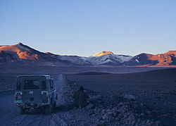
Cerro Escorial
Megjelenés
| Cerro Escorial | |
 | |
| Magasság | 5447 m |
| Hely | Argentína, Chile |
| Hegység | Andok |
| Típus | rétegvulkán |
| Elhelyezkedése | |
 | |
A Cerro Escorial egy 5447 méter magas rétegvulkán Argentína és Chile határán.
Források
[szerkesztés]- Siebert, L. és T. Simkin (2002–). Volcanoes of the World: an Illustrated Catalog of Holocene Volcanoes and their Eruptions. Smithsonian Institution, Global Volcanism Program Digital Information Series, GVP-3. URL: http://www.volcano.si.edu/world/ Archiválva 2008. október 20-i dátummal a Wayback Machine-ben

