
Fájl:USGS Oregon river basins.png

Az előnézet mérete: 739 × 600 képpont További felbontások: 296 × 240 képpont | 591 × 480 képpont | 946 × 768 képpont | 1 262 × 1 024 képpont | 1 849 × 1 501 képpont.
Eredeti fájl (1 849 × 1 501 képpont, fájlméret: 642 KB, MIME-típus: image/png)
|
Ez a fájl a Wikimedia Commonsból származik. Az alább látható leírás az ottani dokumentációjának másolata. A Commons projekt szabad licencű kép- és multimédiatár. Segíts te is az építésében! |
Összefoglaló
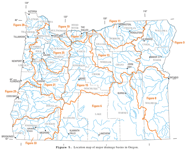
| Leírás | River drainage basins in Oregon. |
| Dátum | |
| Forrás | http://pubs.usgs.gov/wdr/2005/wdr-or-05/pdf/front.pdf (page 51) |
| Szerző | U.S. Geological Survey |
| Engedély (Fájl újrafelhasználása) |
public domain |
Licenc
This image is in the public domain in the United States because it only contains materials that originally came from the United States Geological Survey, an agency of the United States Department of the Interior. For more information, see the official USGS copyright policy.
|
Fájltörténet
Kattints egy időpontra, hogy a fájl akkori állapotát láthasd.
| Dátum/idő | Bélyegkép | Felbontás | Feltöltő | Megjegyzés | |
|---|---|---|---|---|---|
| aktuális | 2013. február 10., 21:52 | | 1 849 × 1 501 (642 KB) | Kmusser | Baker City correction |
| 2011. november 10., 19:55 |  | 1 849 × 1 501 (433 KB) | Finetooth | Corrected my correction of the Grants Pass location. It is a bit further south than I had it on the second version. | |
| 2011. november 10., 04:54 |  | 1 849 × 1 501 (433 KB) | Finetooth | Corrected location of Grants Pass, which is on the Rogue River between the Jackson–Josephine county border and the mouth of the Applegate River. | |
| 2006. október 16., 21:32 |  | 1 849 × 1 501 (723 KB) | EncMstr | {{Information |Description=River drainage basins in Oregon |Source= http://pubs.usgs.gov/wdr/2005/wdr-or-05/pdf/front.pdf page 82 |Date=2006-03-31 |Author=w:USGS |Permission=public domain }} category:Maps of Oregon [[category:Maps of rivers of the |
Fájlhasználat
Az alábbi lap használja ezt a fájlt:
Globális fájlhasználat
A következő wikik használják ezt a fájlt:
- Használata itt: bg.wikipedia.org
- Használata itt: cs.wikipedia.org
- Használata itt: en.wikipedia.org
- Használata itt: it.wikipedia.org
- Használata itt: nl.wikipedia.org
- Használata itt: ru.wikipedia.org
- Használata itt: vi.wikipedia.org