
Fájl:Reichsstädte Offenburg - Gengenbach - Zell am Harmersbach, Michal 1725.png
Az előnézet mérete: 800 × 425 képpont További felbontások: 320 × 170 képpont | 640 × 340 képpont | 1 024 × 543 képpont | 1 920 × 1 019 képpont.
Eredeti fájl (1 920 × 1 019 képpont, fájlméret: 4,68 MB, MIME-típus: image/png)
|
Ez a fájl a Wikimedia Commonsból származik. Az alább látható leírás az ottani dokumentációjának másolata. A Commons projekt szabad licencű kép- és multimédiatár. Segíts te is az építésében! |
Összefoglaló
| Leírás |
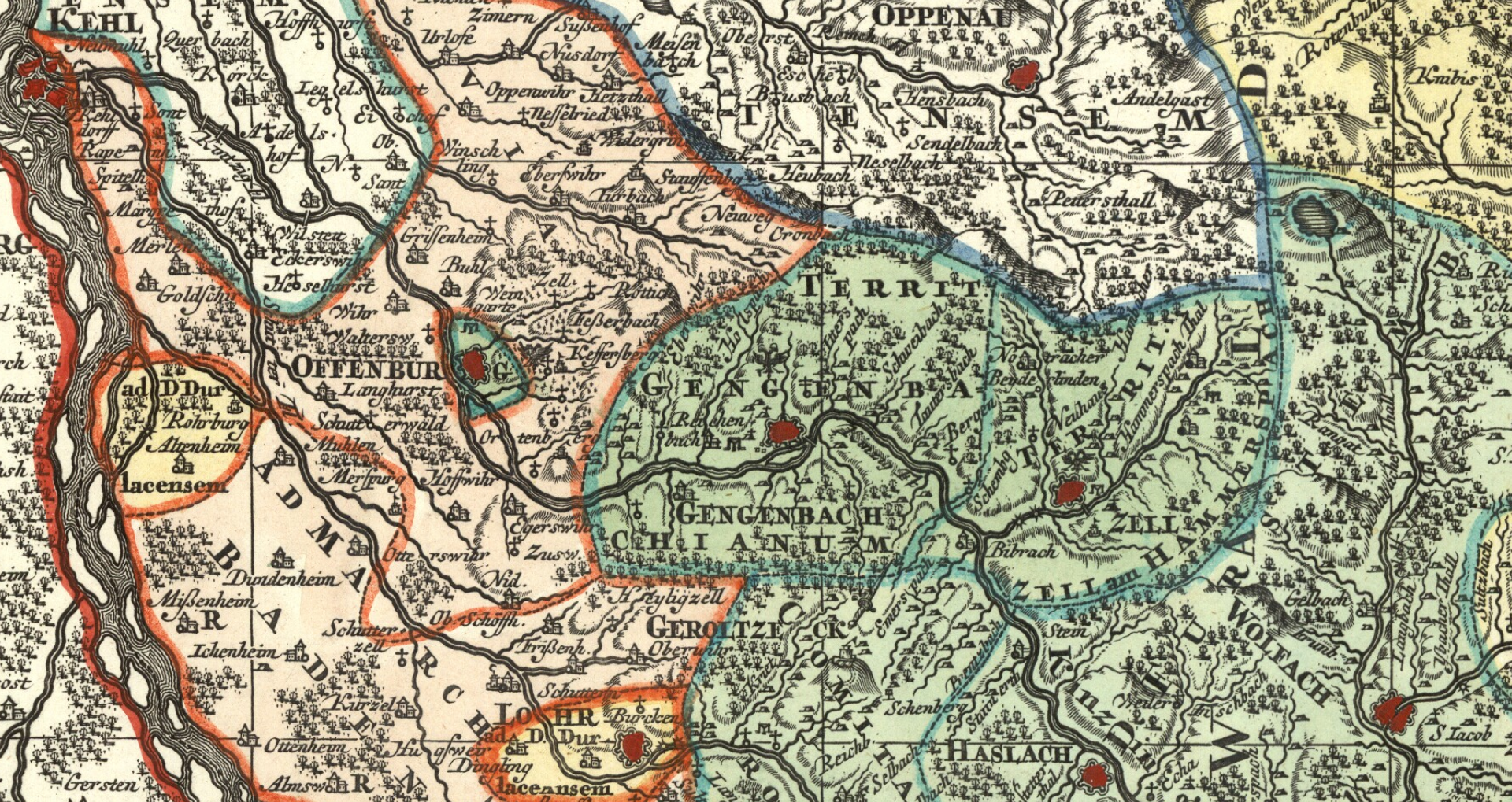
English: Detail cropped out of an 18th century map showing the territories (in the darker green) of the three free imperial cities of Offenburg, Gengenbach and Zell am Harmersbach just east of the Rhine. The last two cities, which were contiguous, ruled over a hinterland, while tiny Offenburg had no hinterland and was entirely surrounded by the Austria-ruled Landvogtei Ortenau. The double-headed eagle next to the name of each cities symbolizes their status as free imperial cities. Cropped out of map four of a nine-map series centered on the Circle of Swabia titled Suevia Universa by Matthäus Seutter and based on information supplied by Jacques de Michal. Published c. 1725-1727. |
| Dátum | |
| Forrás | Moll's map collection |
| Szerző | Matthäus Seutter - Jacques de Michal |
Licenc
|
Ez a mű közkincs abban az országban, ahol elkészítették, és minden olyan további államban, ahol a szerzői jogi védelmi idő a szerző élete plusz 100 év vagy kevesebb. | |
| Megállapították, hogy ez a fájl mentes mindenféle szerzői jogi korlátozástól, beleértve az összes kapcsolódó és hozzátartozó jogot. | |
Fájltörténet
Kattints egy időpontra, hogy a fájl akkori állapotát láthasd.
| Dátum/idő | Bélyegkép | Felbontás | Feltöltő | Megjegyzés | |
|---|---|---|---|---|---|
| aktuális | 2018. szeptember 8., 15:06 | | 1 920 × 1 019 (4,68 MB) | Lubiesque | User created page with UploadWizard |
Fájlhasználat
Az alábbi lap használja ezt a fájlt:
Globális fájlhasználat
A következő wikik használják ezt a fájlt:
- Használata itt: de.wikipedia.org