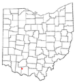
Fájl:OHMap-doton-Winchester.png
Megjelenés
OHMap-doton-Winchester.png (274 × 300 képpont, fájlméret: 10 KB, MIME-típus: image/png)
Fájltörténet
Kattints egy időpontra, hogy a fájl akkori állapotát láthasd.
| Dátum/idő | Bélyegkép | Felbontás | Feltöltő | Megjegyzés | |
|---|---|---|---|---|---|
| aktuális | 2007. október 12., 13:57 |  | 274 × 300 (10 KB) | Nyttend | Reverted to version as of 22:49, 9 July 2007 — wasn't paying attention |
| 2007. október 12., 13:56 |  | 309 × 352 (17 KB) | Nyttend | {{Information |Description=Locator map of the {{w|unincorporated area|unincorporated community}} of {{w|Winchester, Ohio|Winchester}} in {{w|Richland County, Ohio|Richland County}}, {{w|Ohio}}, {{w|United States}}. |Source=Modified from [http://www2.censu | |
| 2007. július 9., 23:49 |  | 274 × 300 (10 KB) | SieBot | {{Information |Description=<br>Adapted from Wikipedia's OH county maps by Catbar. |Source=Originally from [http://en.wikipedia.org en.wikipedia]; description page is/was [http://en.wikipedia.org/w/index.php?title=Image%3AOHMap-doton-Winchester.png here]. |
Fájlhasználat
Az alábbi lap használja ezt a fájlt:
Globális fájlhasználat
A következő wikik használják ezt a fájlt:
- Használata itt: sh.wikipedia.org
- Használata itt: sr.wikipedia.org
- Használata itt: ur.wikipedia.org


