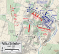
Fájl:Gettysburg Day2 Wheatfield2.png
Megjelenés

Az előnézet mérete: 655 × 600 képpont További felbontások: 262 × 240 képpont | 524 × 480 képpont | 839 × 768 képpont | 1 118 × 1 024 képpont | 2 236 × 2 048 képpont | 3 931 × 3 600 képpont.
Eredeti fájl (3 931 × 3 600 képpont, fájlméret: 7,35 MB, MIME-típus: image/png)
Fájltörténet
Kattints egy időpontra, hogy a fájl akkori állapotát láthasd.
| Dátum/idő | Bélyegkép | Felbontás | Feltöltő | Megjegyzés | |
|---|---|---|---|---|---|
| aktuális | 2023. február 3., 18:40 |  | 3 931 × 3 600 (7,35 MB) | Hlj | improved graphics and detail; now second in series of 4 Wheatfield maps |
| 2012. január 6., 17:25 |  | 2 449 × 1 789 (1,31 MB) | Hlj | Corrected a unit name. Same license. | |
| 2011. április 2., 21:04 |  | 2 449 × 1 789 (1,12 MB) | Hlj | Updated graphical format of rivers and roads. Same license. | |
| 2010. július 31., 01:04 |  | 2 449 × 1 789 (1,08 MB) | Hlj | New version improves accuracy of unit positions and graphic style that matches others in the Gettysburg series. Added legend box. Drawn by Hal Jespersen in Adobe Illustrator CS5. Graphic source file is available at http://www.posix.com/CWmaps/ {{cc-by-3.0 | |
| 2010. július 10., 19:34 |  | 2 449 × 1 789 (1,08 MB) | Hlj | {{Information |Description=Map of Little Round Top (Battle of Gettysburg) of the American Civil War. Updated unit positions and made topographical background consistent with many other Wikipedia Gettysburg maps. Drawn in Adobe Illustrator CS5 by Hal J | |
| 2006. november 16., 16:52 |  | 1 136 × 1 180 (362 KB) | Rheo1905~commonswiki | This map is made by en:User:Hlj. 1863. 7. 2. Gettysburg Second Day, Battle of Wheatfield (1) {{PD-release}} |
Fájlhasználat
Az alábbi lapok használják ezt a fájlt:
Globális fájlhasználat
A következő wikik használják ezt a fájlt:
- Használata itt: cs.wikipedia.org
- Használata itt: da.wikipedia.org
- Használata itt: en.wikipedia.org
- Használata itt: ko.wikipedia.org
- Használata itt: zh.wikipedia.org
