
Fájl:Cotes-dArmor department relief location map.jpg

Az előnézet mérete: 776 × 600 képpont További felbontások: 311 × 240 képpont | 621 × 480 képpont | 994 × 768 képpont | 1 162 × 898 képpont.
Eredeti fájl (1 162 × 898 képpont, fájlméret: 318 KB, MIME-típus: image/jpeg)
|
Ez a fájl a Wikimedia Commonsból származik. Az alább látható leírás az ottani dokumentációjának másolata. A Commons projekt szabad licencű kép- és multimédiatár. Segíts te is az építésében! |
Összefoglaló
| Fényképező elhelyezkedése | | További képek erről a helyről: OpenStreetMap |
|---|
| Leírás |
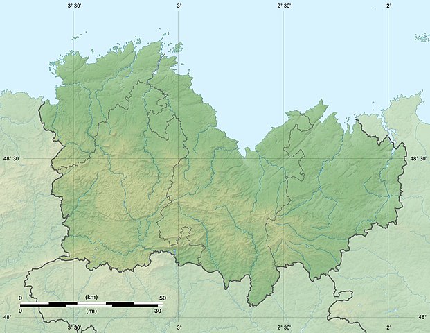
English: Blank physical map of the department of Côtes-d'Armor, France, for geo-location purpose, with distinct boundaries for departments and arrondissements.
Français : Carte physique vierge du département des Côtes-d'Armor, France, destinée à la géolocalisation, avec limite distincte des départements et arrondissements. Scales: 1:520,000 (precision: 130 m) for the topography; 1:7,480,000 (precision: 1,870 m) for the bathymetry
Geographic limits of the map:
|
||
| Dátum | |||
| Forrás |
A feltöltő saját munkája
|
||
| Szerző | Eric Gaba (Sting - fr:Sting) | ||
| Engedély (Fájl újrafelhasználása) |
|
||
| Más változatok |
|

Licenc
Én, e mű szerzője a művemet az alábbi licencek alatt teszem közzé:
Ez a fájl a Creative Commons Nevezd meg! – Így add tovább! 3.0 Unported licenc alapján használható fel.
- A következőket teheted a művel:
- megoszthatod – szabadon másolhatod, terjesztheted, bemutathatod és előadhatod a művet
- feldolgozhatod – származékos műveket hozhatsz létre
- Az alábbi feltételekkel:
- Nevezd meg! – A szerzőt megfelelően fel kell tüntetned, hivatkozást kell létrehoznod a licencre és jelezned kell, ha a művön változtatást hajtottál végre. Ezt bármilyen észszerű módon megteheted, kivéve oly módon, ami azt sugallná hogy a jogosult támogat téged vagy a felhasználásod körülményeit.
- Így add tovább! – Ha megváltoztatod, átalakítod, feldolgozod ezt a művet, a közreműködésedet csak az eredetivel megegyező vagy hasonló licenc alatt terjesztheted.

|
Ez a fájl szabadon másolható, terjeszthető és/vagy módosítható a GNU Szabad Dokumentációs Licenc feltételei alapján, az 1.2 vagy későbbi, a Free Software Foundation által publikált Nem Változtatható szakaszok, Címlapszövegek és Hátlapszövegek nélküli változat szerint. E licenc egy példánya a GNU Szabad Dokumentációs Licenc című fejezetben olvasható. |
A mű a fenti licencek bármelyike szerint felhasználható.
Fájltörténet
Kattints egy időpontra, hogy a fájl akkori állapotát láthasd.
| Dátum/idő | Bélyegkép | Felbontás | Feltöltő | Megjegyzés | |
|---|---|---|---|---|---|
| aktuális | 2010. július 18., 00:40 | | 1 162 × 898 (318 KB) | Sting | Color profile |
| 2008. augusztus 11., 20:43 |  | 1 162 × 898 (291 KB) | Sting | == Summary == {{Location|48|28|30|N|02|49|30|W|scale:1000000}} <br/> {{Information |Description={{en|Blank physical map of the department of Côtes-d'Armor, France, for geo-location purpose, with distinct boundaries for departments |
Fájlhasználat
Az alábbi lap használja ezt a fájlt:
Globális fájlhasználat
A következő wikik használják ezt a fájlt:
- Használata itt: als.wikipedia.org
- Használata itt: ar.wikipedia.org
- Használata itt: br.wikipedia.org
- Használata itt: ceb.wikipedia.org
- Használata itt: cs.wikipedia.org
- Használata itt: cy.wikipedia.org
- Használata itt: de.wikipedia.org
- Használata itt: en.wikipedia.org
- Használata itt: eo.wikipedia.org
- Saint-Brieuc
- Côtes-d'Armor
- Perros-Guirec
- Dinan
- Léhon
- Kastelo de Léhon
- Pommerit-le-Vicomte
- Jugon-les-Lacs
- Guingamp
- Tréguier
- Moncontour (Côtes-d'Armor)
- Quintin
- Pontrieux
- Ŝablono:Geokesto lokumilo Côtes-d'Armor
- Ŝablono:Situo sur mapo Francio Côtes-d'Armor
- Plessix-Balisson
- Paimpol
- Collinée
- Évran
- Caulnes
- Guenroc
- La Vicomté-sur-Rance
- Taden
- Saint-Hélen
- Saint-Samson-sur-Rance
- Bréhat
- Saint-Carné
- Les Champs-Géraux
- Calorguen
A fájl globális használatának megtekintése