Fájl:Cook New Zealand South Cape.jpg
Megjelenés

Az előnézet mérete: 776 × 599 képpont További felbontások: 311 × 240 képpont | 622 × 480 képpont.
Eredeti fájl (800 × 618 képpont, fájlméret: 127 KB, MIME-típus: image/jpeg)
Fájltörténet
Kattints egy időpontra, hogy a fájl akkori állapotát láthasd.
| Dátum/idő | Bélyegkép | Felbontás | Feltöltő | Megjegyzés | |
|---|---|---|---|---|---|
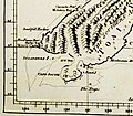
| aktuális | 2007. április 15., 15:59 |  | 800 × 618 (127 KB) | Ibn Battuta | higher resolution of (another version of) Cook's map |
| 2007. április 1., 20:16 |  | 193 × 169 (16 KB) | Ibn Battuta | manually retraced contours of the connection between Stewart Island ("South Cape") and the South Island | |
| 2007. április 1., 20:10 |  | 193 × 169 (16 KB) | Ibn Battuta | shearing is nice, but the map got blurred as a result... back to the original version, only heightened contrast | |
| 2007. április 1., 10:28 |  | 193 × 171 (19 KB) | Ibn Battuta | okay, next try... - heightened contrast | |
| 2007. április 1., 10:26 |  | 193 × 171 (15 KB) | Ibn Battuta | increased contrast | |
| 2007. április 1., 10:21 |  | 193 × 171 (15 KB) | Ibn Battuta | {{Information |Description=South-eastern part of the first nearly complete map of New Zealand, drawn by James Cook. Cook believed that en:Stewart Island was connected to the South Island and thus named it South Cape. |Source= |Date=ca. 1770 | |
Fájlhasználat
Az alábbi lap használja ezt a fájlt:
Globális fájlhasználat
A következő wikik használják ezt a fájlt:
- Használata itt: en.wikipedia.org
