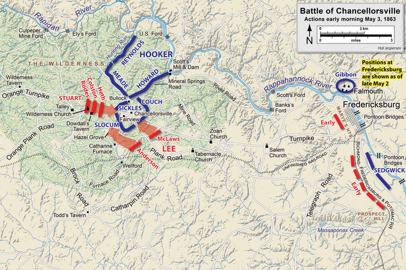
Fájl:Chancellorsville May3a.png
Megjelenés

Az előnézet mérete: 800 × 533 képpont További felbontások: 320 × 213 képpont | 640 × 427 képpont | 1 024 × 683 képpont | 1 280 × 854 képpont | 2 560 × 1 707 képpont | 6 300 × 4 201 képpont.
Eredeti fájl (6 300 × 4 201 képpont, fájlméret: 8,59 MB, MIME-típus: image/png)
Fájltörténet
Kattints egy időpontra, hogy a fájl akkori állapotát láthasd.
| Dátum/idő | Bélyegkép | Felbontás | Feltöltő | Megjegyzés | |
|---|---|---|---|---|---|
| aktuális | 2023. március 14., 19:14 |  | 6 300 × 4 201 (8,59 MB) | Hlj | improved graphics |
| 2012. december 30., 18:52 |  | 2 500 × 1 822 (1,39 MB) | Hlj | Corrected spelling error, made minor graphic improvements | |
| 2011. június 3., 23:16 |  | 2 500 × 1 822 (1,33 MB) | Hlj | Improved the accuracy of the terrain and some landmarks. Same license. | |
| 2011. március 27., 20:33 |  | 2 500 × 1 822 (1,28 MB) | Hlj | Update to graphical style of rivers and roads. Same license. | |
| 2011. január 27., 23:00 |  | 2 500 × 1 822 (1 013 KB) | Hlj | Minor updates to feature labeling and unit positions and actions. {{cc-by-3.0|Map by Hal Jespersen, www.posix.com/CW}} | |
| 2010. november 28., 01:15 |  | 2 500 × 1 822 (1 005 KB) | Hlj | {{Information |Description={{en|1=Map of a portion (May 3, early morning) of the battle of Chancellorsville of the American Civil War. This map partially replaces the map entitled Chancellorsville May3.png. Drawn in Adobe Illustrator CS5 by Hal Jesper |
Fájlhasználat
Az alábbi lap használja ezt a fájlt:
Globális fájlhasználat
A következő wikik használják ezt a fájlt:
- Használata itt: bg.wikipedia.org
- Használata itt: en.wikipedia.org
- Használata itt: es.wikipedia.org
- Használata itt: fr.wikipedia.org
- Használata itt: ms.wikipedia.org
- Használata itt: pt.wikipedia.org
- Használata itt: ro.wikipedia.org
