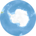
Fájl:Antarctic Ocean relief location map.png
Megjelenés

Az előnézet mérete: 600 × 600 képpont További felbontások: 240 × 240 képpont | 480 × 480 képpont | 768 × 768 képpont | 1 181 × 1 181 képpont.
Eredeti fájl (1 181 × 1 181 képpont, fájlméret: 1,51 MB, MIME-típus: image/png)
Fájltörténet
Kattints egy időpontra, hogy a fájl akkori állapotát láthasd.
| Dátum/idő | Bélyegkép | Felbontás | Feltöltő | Megjegyzés | |
|---|---|---|---|---|---|
| aktuális | 2010. december 24., 12:15 |  | 1 181 × 1 181 (1,51 MB) | Uwe Dedering | initial upload |
Fájlhasználat
Az alábbi lap használja ezt a fájlt:
Globális fájlhasználat
A következő wikik használják ezt a fájlt:
- Használata itt: ba.wikipedia.org
- Használata itt: bg.wikipedia.org
- Használata itt: ce.wikipedia.org
- Használata itt: de.wikipedia.org
- Használata itt: de.wikinews.org
- Használata itt: eo.wikipedia.org
- Használata itt: es.wikipedia.org
- Használata itt: fr.wikipedia.org
- Île Bouvet
- Liste des plus hauts sommets sur Terre
- Îles McDonald
- Île Pierre Ier
- Mer de Weddell
- Passage de Drake
- Île Scott
- Océan Austral
- Île de la Déception
- Modèle:Géolocalisation/Océan Austral
- Île Thompson (île fantôme)
- Îles Larsen
- Île Young
- Antilles australes
- Île Êta
- Îles Omicron
- Pobeda (île)
- Île Eagle (Antarctique)
- Norvegiabåen
- Használata itt: hy.wikipedia.org
- Használata itt: ka.wikipedia.org
A fájl globális használatának megtekintése


