
Fájl:Administrative areas of New Brunswick topographic map-blank.svg

Eredeti fájl (SVG fájl, névlegesen 2 237 × 2 199 képpont, fájlméret: 3,75 MB)
|
Ez a fájl a Wikimedia Commonsból származik. Az alább látható leírás az ottani dokumentációjának másolata. A Commons projekt szabad licencű kép- és multimédiatár. Segíts te is az építésében! |
Összefoglaló
| Leírás |
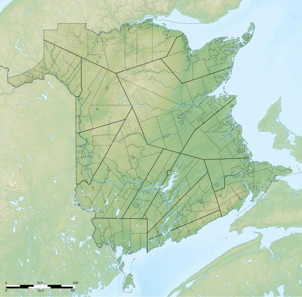
English: Blank topographic map of administrative areas of New Brunswick, Canada. Each area can be selected and colored separately. It have an unique ID, easi to find (for example, Ctrl+F in Inkscape). See the area lists below. Equirectangular projection, WGS84 datum
Geographic limits of the map:
Français : Carte topographique muette des divisions administratives du Nouveau-Brunswick, Canada. Chaque zone peut être sélectionnée et colorée séparément. Elles ont toutes un identifiant unique, facile à trouver (par exemple, Ctrl+F dans Inkscape). Voir les listes des zones ci-dessous. Projection équirectangulaire, système géodétique WGS84.
Limites géographiques de la carte :
|
| Dátum | |
| Forrás |
A feltöltő saját munkája. English:
Français : |
| Szerző | Sémhur (talk) |
| Más változatok |
Administrative areas of New Brunswick with First Nations land topographic map-blank.svg |
| Így nevezd meg (a licenc megköveteli) | © Sémhur / Wikimedia Commons / |
| SVG kód | Ezen nagy SVG kép forráskódja érvénytelen. Ez nagy vektorgrafikus kép Inkscape segítségével készült, or with something else. |
| Fényképező elhelyezkedése | | További képek erről a helyről: OpenStreetMap |
|---|
Licenc
| Copyleft: ez a művészeti alkotás szabadon terjeszthető és/vagy módosítható a Free Art License feltételei alapján. E licenc egy példánya a Copyleft Attitude oldalon és számos más weboldalon olvasható. |
- A következőket teheted a művel:
- megoszthatod – szabadon másolhatod, terjesztheted, bemutathatod és előadhatod a művet
- feldolgozhatod – származékos műveket hozhatsz létre
- Az alábbi feltételekkel:
- Nevezd meg! – A szerzőt megfelelően fel kell tüntetned, hivatkozást kell létrehoznod a licencre és jelezned kell, ha a művön változtatást hajtottál végre. Ezt bármilyen észszerű módon megteheted, kivéve oly módon, ami azt sugallná hogy a jogosult támogat téged vagy a felhasználásod körülményeit.
- Így add tovább! – Ha megváltoztatod, átalakítod, feldolgozod ezt a művet, a közreműködésedet csak az eredetivel megegyező vagy hasonló licenc alatt terjesztheted.
Lists
Local service district
p502300114__Saint-Francois
p502300115__Clair
p502300116__Lac_Baker
p502300117__Baker_Brook
p502300118__Saint-Hilaire
p502300119__Madawaska
p502300120__Saint-Jacques
p502300121__Saint-Joseph
p502300122__Saint-Basile
p502300123__Riviere-Verte
p502300124__Sainte-Anne
p502300125__Notre-Dame-de-Lourdes
p502300126__Saint-Leonard
p502300127__Saint-Andre
p502300129__Drummond
p502300130__Denmark
p502300131__Lorne
p502300132__Grand_Falls
p502300133__Riley_Brook
p502300207__Aberdeen
p502300208__Brighton
p502300209__Kent
p502300210__Northampton
p502300211__Peel
p502300212__Richmond
p502300213__Debec
p502300214__Simonds
p502300215__Wakefield
p502300216__Wicklow
p502300217__Wilmot
p502300218__Woodstock
p502300219__Benton
p502300220__Upper_Kent
p502300221__Coldstream
p502300222__Somerville
p502300223__Glassville
p502300227__Gordon
p502300228__Perth
p502300229__Andover
p502300230__Lakeville
p502300231__Upper_and_Lower_Northampton
p502300312__North_Lake
p502300313__Canterbury
p502300314__Dumfries
p502300315__Prince_William
p502300316__Kingsclear
p502300317__New_Maryland
p502300318__Manners_Sutton
p502300319__McAdam
p502300320__Southampton
p502300321__Queensbury
p502300322__Stanley
p502300323__Bright
p502300324__Douglas
p502300325__St._Mary_s
p502300326__Lincoln
p502300327__Burton
p502300328__Gladstone
p502300329__Blissville
p502300330__Maugerville
p502300331__Sheffield
p502300332__Northfield
p502300335__Upper_Miramichi
p502300336__Keswick_Ridge
p502300340__Canning
p502300341__Petersville
p502300342__Chipman
p502300343__Upper_Gagetown
p502300344__Wirral-Enniskillen
p502300345__Hampstead
p502300346__Gagetown
p502300347__Estey_s_Bridge
p502300348__Rusagonis-Waasis
p502300349__Noonan
p502300352__Brunswick
p502300353__Johnston
p502300354__Waterborough
p502300355__Cambridge
p502300356__Wickham
p502300416__Studholm
p502300417__Cardwell
p502300418__Kars
p502300419__Upham
p502300420__Waterford
p502300421__Hammond
p502300422__Kingston
p502300423__Havelock
p502300424__Springfield
p502300425__Norton
p502300426__Hampton
p502300427__Sussex
p502300428__Westfield_East
p502300429__Rothesay
p502300433__Greenwich
p502300507__Clarendon
p502300508__Campobello
p502300509__Dufferin
p502300510__Dumbarton
p502300511__Lepreau
p502300512__Pennfield
p502300513__Chamcook
p502300514__St._Croix
p502300515__St._George
p502300516__St._Patrick
p502300517__West_Isles
p502300518__St._Stephen
p502300519__St._David
p502300520__St._James
p502300521__White_Head_Island
p502300524__Beaver_Harbour
p502300525__Fundy_Bay
p502300527__Bayside
p502300528__Western_Charlotte
p502300529__Dennis-Weston
p502300552__St._Martins
p502300553__Simonds
p502300554__Fairfield
p502300555__Musquash
p502300614__Elgin_Parish
p502300615__Hillsborough
p502300616__Hopewell
p502300617__Harvey
p502300618__Coverdale
p502300620__Westmorland
p502300621__Botsford
p502300622__Shediac
p502300623__Sackville
p502300624__Dorchester
p502300625__Moncton
p502300626__Salisbury
p502300628__Elgin_Centre
p502300630__Pointe-du-Chene
p502300631__Cape_Tormentine
p502300632__Alma
p502300633__Bayfield
p502300635__Baie_Verte
p502300639__Point-de-Bute
p502300640__Murray_Corner
p502300642__Shediac_Cape
p502300643__Scoudouc_Road
p502300644__Shediac_River-Shediac_Bridge
p502300645__Scoudouc
p502300706__Acadieville
p502300707__Carleton
p502300708__St-Louis-de-Kent
p502300709__St._Charles_(Sud-Kent_Lake)
p502300710__Harcourt
p502300711__St._Paul
p502300712__Saint_Mary
p502300713__Wellington
p502300714__Weldford
p502300715__Dundas
p502300716__Richibucto
p502300717__Cap-de-Richibucto
p502300718__Pointe-Sapin
p502300719__Ste-Anne-de-Kent
p502300720__Aldouane
p502300721__Grand_Saint-Antoine
p502300725__St-Ignace
p502300728__Grand_Digue
p502300759__Alnwick
p502300760__Blackville
p502300761__Blissfield
p502300762__Chatham
p502300763__Derby
p502300764__Glenelg
p502300765__Hardwicke
p502300766__Upper_Miramichi
p502300767__Nelson
p502300768__Newcastle
p502300769__North_Esk
p502300770__South_Esk
p502300771__Rogersville
p502300772__Baie_Ste._Anne
p502300773__Tabusintac
p502300774__Escuminac
p502300775__Renous-Quarryville
p502300776__Oak_Point-Bartibog_Bridge
p502300777__Black_River-Hardwicke
p502300778__Haut_Riviere_de_Portage
p502300782__Portage_River-Tracadie_Beach
p502300783__Fair_Isle
p502300784__Ferry_Road-Russellville
p502300785__Sunny_Corner
p502300787__Brantville
p502300789__St._Margarets
p502300790__Colette
p502300817__New_Bandon
p502300818__Paquetville
p502300819__Parish_Saumarz
p502300820__Shippagan
p502300821__Saint-Isidore
p502300822__Beresford
p502300823__Allardville
p502300824__Bathurst
p502300825__Caraquet
p502300826__Pointe-Brulee
p502300828__Anse-Bleue
p502300829__Petit-Rocher_Sud
p502300831__Cap_Bâteau
p502300832__Chiasson-Savoy
p502300833__Inkerman_Centre
p502300834__Petite-Lameque
p502300835__Robertville
p502300837__Pigeon_Hill
p502300838__St._Simon
p502300839__Tremblay
p502300840__Ste._Cecile
p502300842__Pointe-Sauvage
p502300844__Benoit
p502300845__Haut_Lameque
p502300846__Petit-Rocher_Nord
p502300848__Dugas
p502300850__Baie_de_Petit_Pokemouche
p502300851__LaPlante
p502300852__Miscou_Island
p502300853__Pont_LaFrance
p502300854__Val_Comeau
p502300855__Saint_Pons
p502300856__Haut_Sheila
p502300857__Saint-Sauveur
p502300858__Pont_Landry
p502300859__Paroisse_Notre-Dame-des-erables
p502300863__North_Tetagouche
p502300864__Leech
p502300865__Saint_Irenee_and_Alderwood
p502300866__Saumarez
p502300867__Poirier
p502300868__Pointe_Canot
p502300869__Blanchard_Settlement
p502300870__Côteau_Road
p502300871__Maltempec
p502300872__Pokemouche
p502300873__Sainte-Rose
p502300874__Evangeline
p502300875__Pointe-â-Bouleau
p502300876__Landry_Office
p502300877__Pokesudie
p502300878__Dunlop
p502300879__Riviere_a_la_Truite
p502300880__Haut_Shippagen
p502300881__Big_River
p502300882__Gauvreau_Petit_Tracadie
p502300883__Madran
p502300887__New_Bandon-Salmon_Beach
p502300888__Pointe-Alexandre
p502300906__Blair_Athol
p502300912__St._Quentin
p502300914__St._Jean_Baptiste_de_Restigouche
p502300915__Eldon
p502300916__Addington
p502300917__Dalhousie
p502300918__Balmoral-Maltais
p502300921__Flatlands
p502300922__Balmoral-St-Maure
p502300923__St._Martin
p502300924__Dalhousie_Junction
p502300925__Dundee
p502300927__McLeod
p502300929__Mann_s_Mountain
p502300930__Point_La_Nim
p502300931__Glencoe
p502300934__Menneval
p502300935__White_s_Brook
p502300936__Lorne
p502300937__Chaleur
p502300938__Inkerman
Municipalities
p500300001__Village_of_Alma
p500300002__Village_of_Aroostook
p500300003__Village_of_Atholville
p500300004__Baker_Brook
p500300005__Village_of_Balmoral
p500300006__Village_of_Bas-Caraquet
p500300007__Village_of_Bath
p500300008__City_of_Bathurst
p500300009__Belledune
p500300010__Beresford
p500300011__Bertrand
p500300012__Blacks_Harbour
p500300013__Village_of_Blackville
p500300014__Bouctouche
p500300016__Village_of_Cambridge-Narrows
p500300017__City_of_Campbellton
p500300018__Village_of_Canterbury
p500300019__Village_de_Cap-Pele
p500300020__Town_of_Caraquet
p500300021__Centreville
p500300022__Village_of_Charlo
p500300023__Village_of_Chipman
p500300024__Village_of_Clair
p502300722__Cocagne
p500300025__Town_of_Dalhousie
p500300026__Dieppe
p500300027__Village_of_Doaktown
p500300028__Village_of_Dorchester
p500300029__Village_of_Drummond
p500300030__Edmundston
p500300031__Village_of_Eel_River_Crossing
p500300032__Florenceville-Bristol
p500300033__The_City_of_Fredericton
p500300034__Village_of_Fredericton_Junction
p500300035__Village_of_Gagetown
p500300036__Grand_Bay-Westfield
p500300037__The_Town_of_Grand_Falls-La_Ville_de_Grand-Sault
p500300038__Grand_Manan
p500300039__Grande-Anse
p500300040__Hampton
p502300337__Hanwell
p500300041__Town_of_Hartland
p500300042__Village_of_Harvey
p500300043__Village_of_Hillsborough
p500300044__Village_of_Kedgwick
p500300045__Village_of_Lac_Baker
p500300046__Lameque
p500300047__Le_Goulet
p500300048__Maisonnette
p500300049__Village_of_McAdam
p500300050__Meductic
p500300051__Memramcook
p500300052__Millville
p500300053__Village_of_Minto
p500300054__Miramichi
p500300055__Moncton
p500300056__Nackawic
p500300057__Neguac
p500300058__New_Maryland
p500300059__Nigadoo
p500300060__Village_of_Norton
p500300061__Oromocto
p500300062__Village_of_Paquetville
p500300063__Village_of_Perth-Andover
p500300064__Village_of_Petitcodiac
p500300065__Village_of_Petit_Rocher
p500300066__Plaster_Rock
p500300067__Village_de_Pointe-Verte
p500300068__Village_of_Port_Elgin
p500300069__Quispamsis
p500300070__Village_of_Rexton
p500300071__Richibucto
p500300072__Village_of_Riverside-Albert
p500300073__The_Town_of_Riverview
p500300074__Village_of_Riviere-Verte
p500300075__Rogersville
p500300076__Rothesay
p500300077__Town_of_Sackville
p500300078__Town_of_Saint_Andrews
p500300079__Town_of_St._George
p500300080__The_City_of_Saint_John
p500300081__Saint-Leolin
p500300082__Saint-Quentin
p500300083__Village_of_Sainte-Anne-de-Madawaska
p500300084__Village_de_Saint-Antoine
p500300085__Village_of_Saint-Francois_de_Madawaska
p500300086__Saint-Isidore
p500300087__Saint-Louis_de_Kent
p500300088__Salisbury
p500300089__Shediac
p500300090__Town_of_Shippagan
p500300091__Village_de_St._Andre
p500300092__Village_de_St._Hilaire
p500300093__Town_of_St._Leonard
p500300094__Village_of_St._Martins
p500300095__The_Town_of_St._Stephen
p500300096__Village_of_Stanley
p500300097__Sainte-Marie-Saint-Raphael
p500300098__Town_of_Sussex
p500300099__Village_of_Sussex_Corner
p500300100__Village_of_Tide_Head
p500300101__Tracadie
p500300102__Village_of_Tracy
p500300103__Woodstock
p500300104__Beaubassin_East
Note: Grimmer (502300913) has been almalgamated with Kedgwick on July 1st 2012 to create a rural community. Grimmer (502300913) a été fusionné avec Kedgwick le 21 juillet 2012 pour former une communauté rurale.
Fájltörténet
Kattints egy időpontra, hogy a fájl akkori állapotát láthasd.
| Dátum/idő | Bélyegkép | Felbontás | Feltöltő | Megjegyzés | |
|---|---|---|---|---|---|
| aktuális | 2015. július 3., 06:43 | | 2 237 × 2 199 (3,75 MB) | Red Castle | Mise à jour Tracadie et Atholville |
| 2014. május 26., 10:22 |  | 2 237 × 2 199 (3,79 MB) | Sémhur | Valid SVG | |
| 2014. május 25., 01:21 |  | 2 237 × 2 199 (3,79 MB) | Red Castle | Mise à jour Hanwell et Cocagne | |
| 2012. augusztus 12., 18:31 |  | 2 237 × 2 199 (3,79 MB) | Dr Wilson | Correction mineure. | |
| 2012. augusztus 12., 18:27 |  | 2 237 × 2 199 (3,79 MB) | Dr Wilson | Kedgwick est devenu une communauté rurale. | |
| 2011. október 9., 20:25 |  | 2 237 × 2 199 (3,77 MB) | Sémhur | + Metadata | |
| 2011. október 9., 20:15 |  | 2 237 × 2 199 (3,77 MB) | Sémhur | == {{int:filedesc}} == {{Information |Description={{Multilingual description |en=Blank topographic map of administrative areas of New Brunswick, Canada.<br> Each area can be selected and colored separately. It have an unique ID, easi |
Fájlhasználat
Az alábbi lap használja ezt a fájlt:
Globális fájlhasználat
A következő wikik használják ezt a fájlt:
- Használata itt: fr.wikipedia.org